Topographical Survey
Services » Topographical Survey

TOPOGRAPHICAl survey

we provide comprehensive geotechnical investigation services designed to deliver accurate and reliable data for your project's foundation and subsurface analysis. With advanced techniques and expert professionals, we ensure every test meets industry standards and client expectations.

Our Survey Capabilities

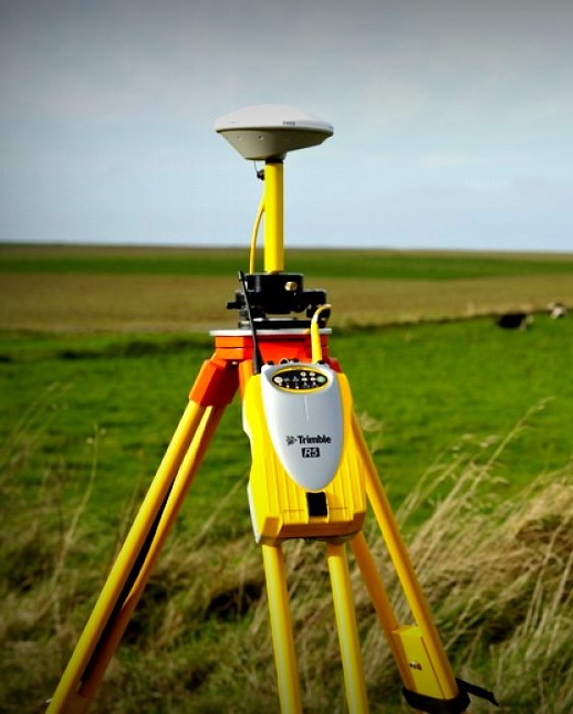
We offer comprehensive terrain mapping using advanced equipment like Total Stations, DGPS, and drones to deliver detailed contour maps, elevation models, and site layouts. Our customized surveys cater to road alignments, building layouts, reservoirs, and slope analysis, ensuring accurate data collection of natural features and man-made structures for effective project planning.
DGPS & Total Station Survey

  • DGPS Survey
  • Static Observations Point Generation
  • RTK (Real Time Kinematic survey)
  • PPK Survey
  • Total Station Survey
  • RTK Survey with CORS Station
  • Obtaining Point from Survey of India
  • TBM / Benchmark Construction 
  • Detailed Contour Survey
  • Cross Sectional and Longitudinal Survey

LiDAR & Drone Survey

  • Drone Survey (Photogrammetry) survey
  • Drone Videography of Project
  • GCP (Ground Control Point) Marking
  • Point Cloud and Data Processing

Survey Categories

  • Topographical Survey for Tunnel Alignment
  • Topographical Survey for Road & Highway Alignment
  • Topographical Survey for Pumped Storage Project, Hydro power Project
  • LiDAR Survey for Mines, PSP, Hilly rough terrain
  • Cadastral Survey 
dgps
''GEO WINGS ENGINEERING PVT LTD, a top Topographical Survey company in Delhi NCR, offers reliable Topo survey, Drone and LiDAR survey, ensuring high-quality solutions for your projects.''